
This is a re-post of one I did many years ago. It will give you the directions for exercising with a trip around the lake. Please be sure to observe social distancing. We are getting some beautiful weather and getting outside to enjoy it is a real treat.
 Absolutely one of the best features of living in Lake Oswego is the ability to enjoy the lake. And one of my favorite ways to enjoy it is by riding a bike, or taking a walk or a jog around it. The first time I ran the lake was in 1980. I have done it many, many times since then. Although I have to admit that these days instead of running it, I bike or walk it. It’s just about 8 miles all the way around. Biking it, the challenge is to do it in one hour’s time. I know that does not seem very fast, but there are two substantial hills in the ride and if you can do it in an hour, you are kicking some serious #*%*. Walking it takes about 2.5 hours, and running it, back in my hey day, took just over an hour.
The route around the lake is not an obvious course. You need to have someone who has done it before show it to you. I suppose you could just journey out and figure it out, but there are a couple of spots where taking the right turn will not only make the route more enjoyable, but it will also make it more safe.
I am going to outline the basic route. **UPDATED: MAP AT BOTTOM OF THIS ARTICLE**
I will try to keep the directions easy to follow. I do the route in a clockwise circle. You can reverse it if you like, but I do it clockwise because with this route you warm up properly for the hills and then also cool down before you finish.
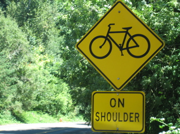
 Start at the Lake Grove Swim Park, which is just North of the intersection of Southshore Blvd and Lakeview Blvd, along Lakeview Blvd. Proceed North on Lakeview. I suppose it is actually slightly Northeast, but for the sake of keeping it simple, head North along the shoulder of the road. There is a nice wide bike path and you’ll be enjoying the view of the lake and the stately mansions. You will go about half a mile before you come to the first right hand turn.
This is Summit. Yes, it’s called Summit because it’s a big hill. Summit will take you on a slightly winding route up to the top and then back down again. These are some of the best views of the lake because you are up so high and you really get to see the width and breadth of the water.
After you come down the hill, Summit will dead-end at Iron Mountain Blvd. Turn right which will have you heading East. This is a long, flat stretch of road through a heavily treed area with views of the Lilly Pond. Most of the length of this section does not have houses on it. As you come back into the housing area, in fact almost immediately as soon as the driving speed goes from 40 MPH to 25MPH, you want to watch for a sharp right turn just on the edge of the lower parking lot for Lake Oswego Country Club. This little street is called Milligan Lane. It is only a couple of hundred of feet long, and I don’t think it is well marked. So be watching and don’t miss it. If you miss it, you’ll add about a mile and a good deal of time lost in the surrounding neighborhoods trying to get back on course.
Milligan Lane will take you over a set of train tracks and drop you right on to Northshore Road. Turn left so that you are continuing to head East. This is just a spectacular stretch of scenery. You will be right down at the level of the lake meandering by fabulous homes and across quaint bridges with views of the lake and of Lakewood Bay. The road takes a couple of twists and turns, just follow the signs that identify Northshore. One of the homes you will pass, it will be on your right just before the humongous rock formation, is the house that was briefly occupied by Humphrey Bogart and his 3rd wife, Mayo Methot, or so local legend has it.
After you  cross the bridge with the view to the left of Lakewood Bay you will come to a 3-way stop, turn left. Go about a block and take the first right. This is is Fairmont. You are only going to go about 100 feet before you turn left onto Middlecrest. Middlecrest is not a through street. It has a barrier erected to keep out auto traffic, but there is a pass through for bikes and pedestrians. Stay on Middlecrest a couple of blocks to the traffic light at State Street.
Turn right on State Street and go a long block to the bottom of the hill where there is another traffic light at McVey Avenue. Turn right and head up McVey. This is the big hill in this route. Pace yourself because when you think you’ve gotten to the top, you have not. You could stay on it up to the traffic light at Southshore, but I have found another route that I like that is more scenic and just more interesting.
Before you get to the traffic light at McVey there is a right hand turn at Oak. Take this right and follow the route as it levels out and gives you a bit of a breather before the climb starts again. You’ll cross a little bridge in an area that feels like a grotto. It is cool and moist and very refreshing on a hot day. Just after the little bridge you’ll turn right onto Palisades Terrace. This is another beautiful neighborhood where the houses will completely distract you from your saddle sores or your tired feet. You are now about 5 miles into the route with just a couple more to go. The uphill climb starts again while you are on Palisades Terrace. You’ll know you’re there, believe me. Palisades Terrace dead ends at Southshore Blvd.
Turn right at Southshore so that you are heading West. You’ll continue to climb for about half a mile. At the top, not only is there a bench where you can sit and look out at the lake, but there is also a drinking fountain. Yahoo! Continue down Southshore as you descend the hill and begin to cross the canals. Southshore will end at Lakeview Blvd, where when you turn right you will find yourself back at the beginning where you started.
Once upon a time this was a pretty treacherous route because you shared the road with cars. Today, pretty much the whole way is either on quiet neighborhood streets or has nice bike paths to separate you from the cars.
What I like about it is that it has a variety of terrain. There are a couple of hills to challenge, but not beat you up too badly, and there are so many great views of homes and the lake.
I do have a slight modification I do for the bike ride at the bottom of McVey that will put you onto a more gentle climb up the hill. For the sake of wearing out my welcome in your brain today, I am not including it here. But if you’d like to know it, drop me an e-mail and I”d be happy to share. (diannegregoire@oregonfirst.com) Or perhaps it will become a future posting.
If you do try my route around the lake I’d love to hear from you. I also apologize if somehow my directions are confusing or get you lost. As always, I think in this public venue I should remind you to observe the rules of the road, wear a helmet, and stay safe. I think you’ll find that it is an amazing way to get some exercise and to take advantage of this great town. Enjoy!